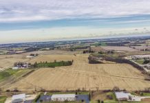
January 8, 2020 – West Bend, WI – Armchair historians from West Bend are honing in on the timeline of the aerial photo overlooking S. Main Street.
The huge framed photo is in an office on the second floor at City Hall in West Bend. The picture measures about 5 feet x 9 feet.
Neighbors will easily recognize the old West Bend High School, the Amity Building and Holy Angels Cemetery.

Are you able to pick out McLane Elementary and the tree-lined streets of Chestnut Street, Eighth Avenue and Summit Drive.

Can you see the old Train Depot, Gehl Company, and is that Lynn’s Wastepaper in the bottom left-hand corner? How about Enger Kress, the Gehl Company and is that West Bend Transit?

The sewage treatment plant and in the video you can see the poor farm and Indiana Avenue isn’t a street that runs through.

Regner Park and lots of open farm fields to the north.

West Bend Company and the Milwaukee River. What else do you recognize?

Can you identify this location on S. Main Street and across the river to the east? Can you spot the West Bend Theatre? How about this corner below?

Any help identifying buildings or the era appreciated. Have fun!
How about the old ice skating rink on Sixth Avenue and Oak Street?

Click HERE for more videos: Remember when….


