


March 15, 2026 – West Bend, Wi – The West Bend/Washington County, Wi area is getting clobbered with power outages and now Phase II as snow is on the way. Aron Rodman, owner of Extra Mile Snow Plowing said Sunday afternoon has largely been a waiting game for crews watching the weather transition. Crews headed out earlier in the storm to prepare surfaces before conditions deteriorate.
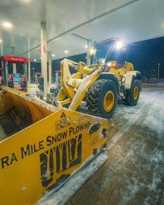
“We went out a day ago, salted everything, knowing this was coming,” he said. “So just wanted to get some salt down right away.”

Rodman said workers made another brief round Sunday morning to touch up key locations.
“This morning we just went and touched up the churches and clinic, a couple little places, like six,” he said. “And then now we’ve just been waiting, because it’s just been rain here.”
According to Rodman, the rain was expected to taper off late Sunday afternoon, creating a short window for more preparation before snow begins.
“Rain’s supposed to stop around like five,” he said. “So we’re going out at five, and we’re going to try — there’s a little break in there, and then the snow starts.”
During that window, crews will focus on salting parking lots and pavement to prevent dangerous icing.
“We’re going to try and get around to salt, get everything salted between five and 8 p.m. just so that there’s not a sheet of ice under everything,” Rodman said.
Once snowfall begins, the real work will start early Monday morning.
“We’re going to let it start snowing tonight, and then we’re going to head out at three in the morning and just start plowing everything,” he said. “We’ll plow at once, and then we’ll be plowing lanes through parking lots during the day tomorrow to keep things open.”
After businesses close and vehicles leave lots, crews plan another full cleanup pass.
Rodman noted the storm has been highly variable across the region, with areas just north already seeing significant snow while West Bend remained mostly rain Sunday afternoon.
“We’re right on the line here in West Bend,” he said. “There’s nothing sticking to the roads in West Bend — it’s just rain. Kewaskum’s got like two inches of slush sitting on all the pavement.”
The difference grows more dramatic farther north.
“There’s like a 30-mile range where here it’s rain, and 30 miles north of here they’re getting pounded with snow,” Rodman said. “As of a couple hours ago they had, I think, 18 inches on the ground already up by Wausau.”

Ice buildup on trees has also raised concerns about potential branch damage and additional power outages as winds increase later Sunday.
“There’s a lot of ice on the branches already,” Rodman said. “I’ve seen it worse. There’s icicles all over everything, but it’s not like there’s a half inch of ice over every branch.”
He said some limbs could still snap, especially as winds are expected to increase.
For now, crews across the area remain on standby, ready to move once the storm shifts fully into snow.

Below is the latest webinar from the National Weather Service.

This Afternoon and Early Evening:
- Wintry mix in portions of southern Wisconsin, see the attached graphic for details.
- Rain in far southeast Wisconsin before changing over this evening. Standing water in ditches and low lying areas in far southeast Wisconsin
Tonight into Monday:
- Winter Storm Warning: now through 4 PM Mon.
- Snow Totals: 5–10 inches, with gusty northwest winds that may approach blizzard conditions, mainly toward central WI.
- Hourly Snow Rates: The highest hourly snow rates are expected after midnight through daybreak with rates of 0.5 to 1 inch per hour. Briefly higher rates cannot be ruled out.
- Snow characteristic: Snow will start off wetter, which may stick more to trees and powerlines. As temperatures drop, expect it to transition toward drier snow, making it more susceptible to blowing and drifting with the strong winds.
- Winter Weather Advisory: Milwaukee, Racine and Kenosha counties from 7 PM Sun to 4 PM Mon.
- Rain will transition to snow from west to east during the evening. There may be a period of freezing rain during the transition.
- 2-4 inches of snow is expected tonight through Monday
- A Winter Storm Warning is now in effect for all of southern Wisconsin now through 4 PM Monday, except Milwaukee, Racine, and Kenosha counties
- The Winter Weather Advisory for far southeast Wisconsin was moved up to 7 pm tonight.