


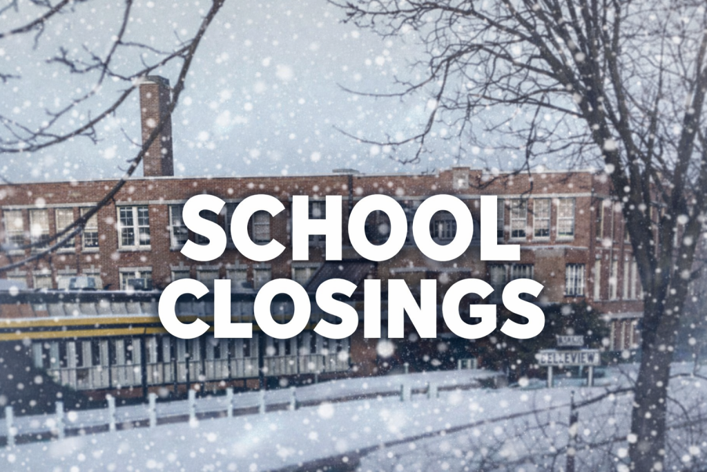
March 15, 2026 – Washington County, Wi – Schools across Washington County, Wi, are now starting to make it official – cancelling classes on Monday, March 16, 2026, because of current weather conditions.
As of 8:30 p.m. Sunday night schools announced closing:
- Kettle Moraine Lutheran High School
- Ozaukee Christian School
- Germantown School District
- Slinger School District
-
Due to inclement weather, there will be no school tomorrow, Monday, March 16, 2026. This includes Holy Trinity School, St. Lucas School, and Community Christian Academy.Additionally, all evening events for the Kewaskum School District are cancelled.
- Hartford Union School District
- West Bend School District
- The National Weather Service issued a Winter Storm Warning for our area starting at 7PM this evening until 4PM Monday. The combination of snow, strong winds and ice will impact travel tomorrow morning and could cause sporadic power outages. Therefore, the Slinger School District will be canceling school tomorrow, Monday, March 16. All after school activities are also canceled.
Area businesses have also announced closings/delays:
– A1 Health & Fitness has cancelled early morning classes. The 9:30 a.m. class has yet to be determined
-Maus Jewelers in West Bend will be closed Monday, March 16, 2026.
-Interfaith Caregivers of Washington County will be closed Monday. Due to expected weather conditions, the Interfaith office will be closed tomorrow, Monday, March 16. Staff will be working remotely and monitoring phone calls. Non-emergency messages will be returned on Tuesday, March 17. Thank you for your understanding, and please stay safe!
As of 8:44 p.m. there were 7771 power outages across Washington County, WI. There were 5500 outages in West Bend, Wi.
This is a working story and more information will be posted when details are available.

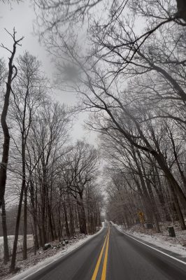
March 15, 2026 – Washington Co., Wi – A thin sheet of ice hangs off the road sign as Washington County, WI, feels the wintery wrath of Mother Nature. Around 3 p.m. Sunday afternoon the roads are slick and there’s significant ponding as heavy rain blankets the area. We Energies is reporting about 1573 power outages in Washington County with over 1200 in West Bend, Wi. A series of updates are posted below.
The Wisconsin Department of Transportation (WisDOT) urges people to stay home and limit travel to emergencies only during the current winter storm.
Travel is not advised across northern Wisconsin as blizzard conditions continue to make highways extremely hazardous and often impassable. As of 3 p.m. northern counties were reporting over a foot of snow. The winter storm is expected to cause continued deteriorating conditions in southern counties as the storm progresses.

The National Weather Service (NWS) has issued blizzard warnings extending into Monday (March 16) across the impacted areas in northern Wisconsin. Heavy snowfall, whiteout visibility, dangerously high winds, and blowing and drifting snow are significantly impacting road conditions. Snowplows in northern Wisconsin are struggling to keep up in many locations, and some secondary routes have suspended winter maintenance operations to focus resources on primary roads.
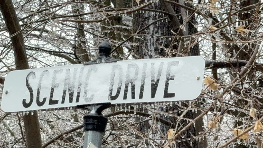
 Closer to home ice forms on branches lining local roadways. Temperatures are holding steady at the freezing mark, 32 degrees.
Click arrow in lower-left corner to advance the page
Checking on neighbors on 16th Avenue and Walnut Street in West Bend, Wi. Last summer nearly a dozen homes were affected by severe flooding as the creek crested its banks and sewers backed up.
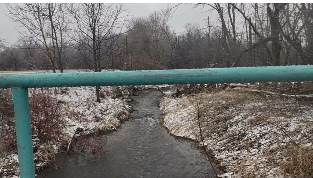
Homeowners are nervously keeping an eye on their property as the creek flows rapidly and water begins to collect in the street.
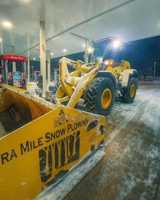
Aron Rodman, owner of Extra Mile Snowplowing said the rain should stop around 5 p.m. and as temperatures drop, snow will start around 8 p.m. and continue through 6 p.m. Monday, March 16, 2026.

March 15, 2026 – Washington Co., Wi – Neighbors across Washington County and the rest of southeastern Wisconsin are under a Winter Weather Advisory, which could be upgraded to a Winter Storm Warning as a much-anticipated system moves across the state. More details below. Feel free to share your photos.
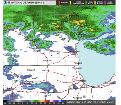
According to the National Weather Service:
Through Mid-Morning Today:
Winter Weather Advisory through this morning for snow turning to a wintry mix of sleet/freezing rain with a glaze up to a quarter an inch of ice on top of the 1-3 inches of snow that has already fallen.

Wintry mix may end earlier, and the Winter Weather Advisory may be canceled early if this occurs.
Milder temperatures south of I-94, w/ some non-accumulating wintry mix to rain this morning.
Mid-Morning – This Afternoon:
Milder temps spread northward this afternoon with breaks in precip.
Expect intermittent light wintry mix/snow into central WI where temps hover around freezing.
Scattered rain chances and isolated thunderstorms will affect much of southern WI, where temperatures will be in the 40s and 50s.
Areas closer to the WI/IL border and southeast WI may see a few isolated thunderstorms capable of producing small hail.
This Evening – Mon Afternoon:
Winter Storm Warning: North of a line from Beloit to Cedar Grove, expect a transition from rain to wintry mix to snow through the evening.
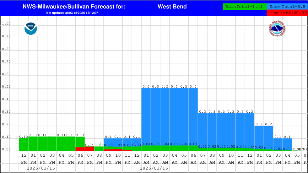
Snow Totals: 6–10 inches, with gusty northwest winds that may approach blizzard conditions, mainly toward central WI.
Hourly Snow Rates: The highest hourly snow rates are expected after midnight through daybreak with rates of 0.5 to 1 inch per hour.
Snow characteristic: Snow will start off wetter, which may stick more to trees and powerlines. As temperatures drop, expect it to transition toward drier snow, making it more susceptible to blowing and drifting with the stronger winds.
Winter Weather Advisory:Southeast WI, wintry mix changing to snow.
Milder temps, a later start time after 10 pm tonight, and lower snow rates (less than 0.5 inch per hour) will result in less snow for southeast WI, but still expect 2-5 inches across this area.
Today
Rain or freezing rain, becoming all rain after 8am. High near 43. Breezy, with an east wind 15 to 20 mph becoming north in the afternoon. Winds could gust as high as 35 mph. Chance of precipitation is 100%. Total daytime ice accumulation of less than a 0.1 of an inch possible.
Tonight
Rain, snow, freezing rain, and sleet before 3am, then snow, possibly mixed with sleet between 3am and 4am, then snow after 4am. The snow could be heavy at times. Widespread blowing snow, mainly after 4am. Low around 18. Windy, with a north wind 25 to 30 mph, with gusts as high as 40 mph. Chance of precipitation is 100%. New ice accumulation of less than a 0.1 of an inch possible. New snow and sleet accumulation of 1 to 2 inches possible.

Monday
Snow, mainly before 1pm. The snow could be heavy at times. Widespread blowing snow, mainly before noon. High near 21. Wind chill values between zero and 5. Windy, with a northwest wind 25 to 30 mph, with gusts as high as 40 mph. Chance of precipitation is 80%. New snow accumulation of 1 to 2 inches possible.
Monday Night
Mostly cloudy, then gradually becoming mostly clear, with a low around 4. Wind chill values between -10 and zero. Blustery, with a northwest wind 15 to 20 mph decreasing to 10 to 15 mph after midnight. Winds could gust as high as 30 mph.
Tuesday
Sunny, with a high near 21. Northwest wind around 10 mph.
Tuesday Night
Snow likely, mainly after 1am. Mostly cloudy, with a low around 14. South wind 5 to 10 mph. Chance of precipitation is 70%. New snow accumulation of less than one inch possible.
Wednesday
A 20 percent chance of snow before 1pm. Cloudy, then gradually becoming mostly sunny, with a high near 41. South wind around 10 mph.
Wednesday Night
A 20 percent chance of rain after 1am. Mostly cloudy, with a low around 32. Southwest wind around 5 mph.
Thursday
Sunny during the morning, then mostly cloudy during the afternoon, with a high near 45.