


May 14, 2025 – Washington Co., WI – The National Weather Service said there continues to be a threat for severe thunderstorms on Thursday.
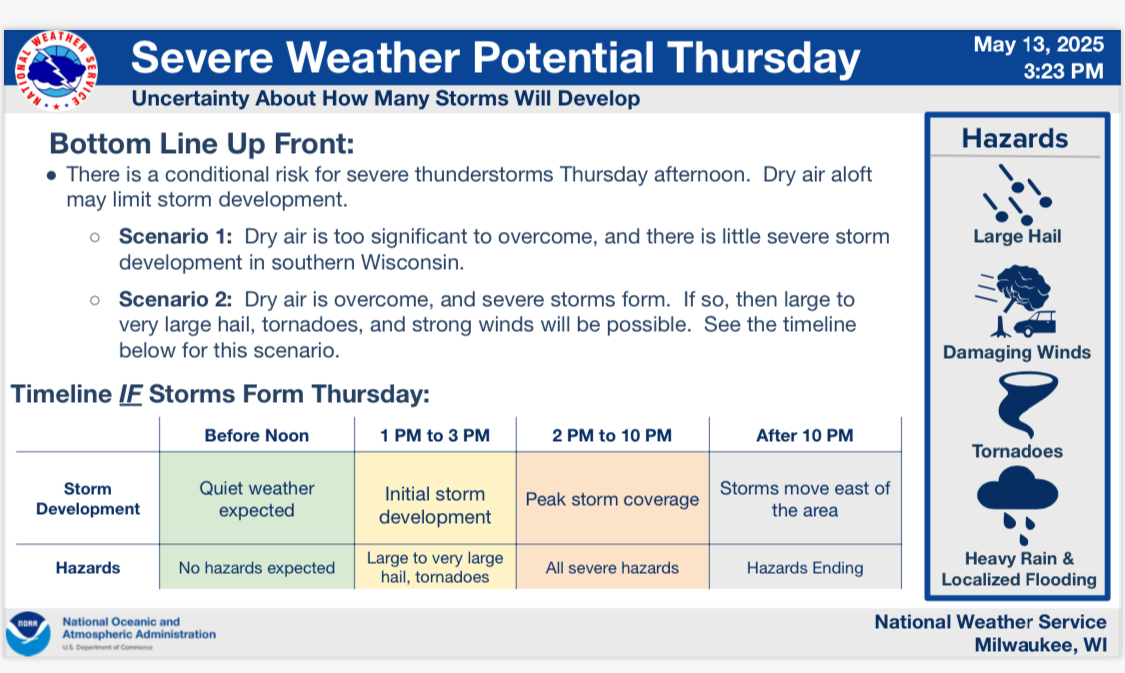
There is a chance that dry air may limit storm coverage in some areas, especially south of I-94. However, IF storms do form, then all severe hazards will be possible, including very large hail, tornadoes, and strong wind gusts.

If storms do form, initial development will be over the western portion of the state during the early afternoon hours, with movement toward the east-northeast during the afternoon and evening. 2-10 p.m. is currently the most favored window for the threat of severe weather on Thursday.
The overall potential for severe weather on Thursday has increased, though there is still considerable uncertainty with storm coverage due to dry air in the mid levels of the atmosphere.