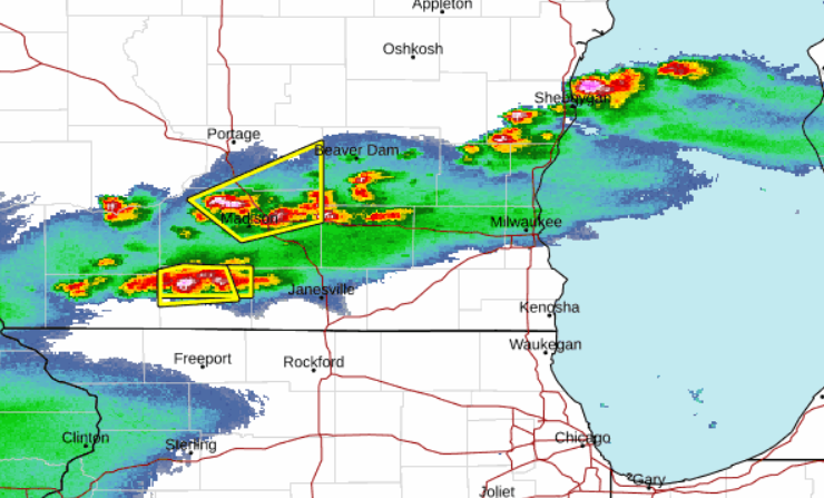
April 27, 2024 – Washington Co., WI – A severe thunderstorm watch has been issued for Washington County and surrounding areas by the National Weather Service.
Click HERE to SUBSCRIBE to FREE local news at
Washington County Insider on YouTube
A severe thunderstorm watch is in effect until 12 a.m. for the following counties:
Columbia, Fond du Lac, Milwaukee, Rock, Washington, Dane, Jefferson, Ozaukee, Sheboygan, Waukesha, Dodge, Kenosha, Racine and Walworth.

Scattered strong to severe storms are expected to continue throughout the evening.
From the National Weather Service:
Do you know the difference between a National Weather Service Severe Thunderstorm Watch and a Severe Thunderstorm Warning? Check your knowledge below.
Severe Thunderstorm Watch: Be Prepared! Severe thunderstorms are possible in and near the watch area. Stay informed and be ready to act if a severe thunderstorm warning is issued. The watch area is typically large, covering numerous counties or even states.
Severe Thunderstorm Warning: Take Action! Severe weather has been reported by spotters or indicated by radar. Warnings indicate imminent danger to life and property. Take shelter in a substantial building. Get out of mobile homes that can blow over in high winds. Warnings typically encompass a much smaller area (around the size of a city or small county) that may be impacted by a large hail or damaging wind identified by an NWS forecaster on radar or by a trained spotter/law enforcement who is watching the storm.