


July 6, 2021 – Washington Co., WI – The temps have noticeably cooled and the National Weather Service has issued a “significant weather advisory” for northeastern Washington County and northern Ozaukee, Fond du Lac, and Sheboygan Counties.
Click HERE for updated radar from the National Weather Service
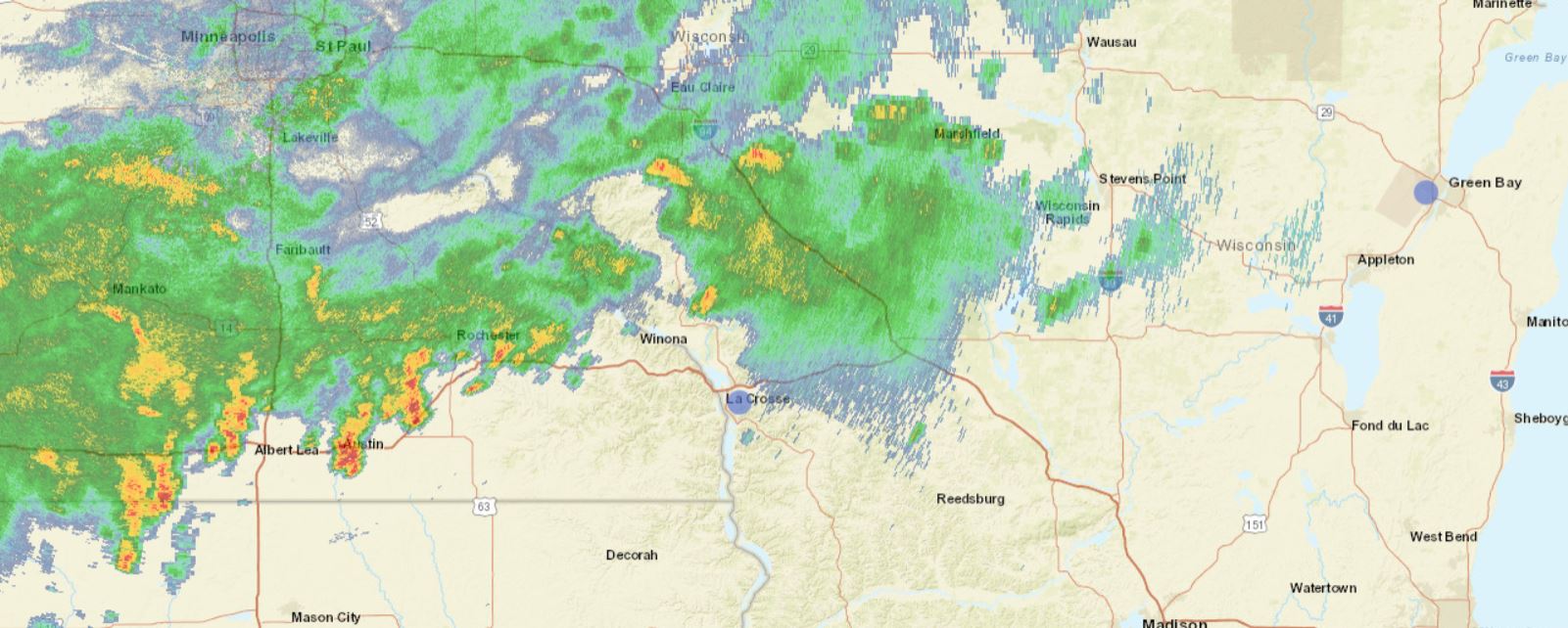
The advisory runs until 8:30 p.m. as Doppler radar is tracking a line of strong thunderstorms carrying gusty winds up to 50 miles per hour along with half-inch hail.

In addition, temporary heavy rainfall could lead to brief localized flooding. Locations impacted include… Sheboygan, Fond Du Lac, Port Washington, Plymouth, Sheboygan Falls, North Fond Du Lac, Saukville, Kewaskum, Howards Grove, Oostburg, Belgium, Fredonia, Kohler, Cedar Grove, Campbellsport, Random Lake, Newburg, Oakfield, Elkhart Lake and Southern Lake Winnebago.
PRECAUTIONARY/PREPAREDNESS ACTIONS… Frequent cloud to ground lightning is occurring with these storms. Lightning can strike 10 miles away from a thunderstorm. Seek a safe shelter inside a building or vehicle.
A Severe Thunderstorm Watch remains in effect until 10 p.m. for southeastern and east central Wisconsin.