June 10, 2026 – Washington Co., Wi – A strong weather system is gearing up to pass through Washington County, Wi over the next 48 hours.
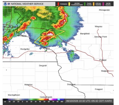
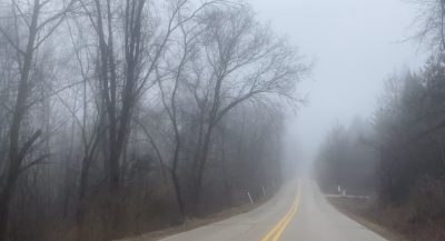
According to the National Weather Service there is a dense fog advisory until 7 a.m. and then neighbors can expect heavy rain, along with a mix of sun and temps in the mid-80s. A complete 2-day forecast is below.
Showers and thunderstorms likely, mainly between 3pm and 5pm. Some of the storms could be severe. Areas of dense fog before 9am. Otherwise, partly sunny, with a high near 86. South wind 5 to 10 mph increasing to 10 to 15 mph in the afternoon. Winds could gust as high as 30 mph. Chance of precipitation is 60%. New rainfall amounts between a half and three quarters of an inch possible.

Wednesday Night
Showers and thunderstorms likely, mainly before 1am. Some of the storms could be severe. Cloudy, then gradually becoming partly cloudy, with a low around 67. Southwest wind 10 to 15 mph, with gusts as high as 30 mph. Chance of precipitation is 60%. New rainfall amounts between a quarter and half of an inch possible.
Thursday
Showers and thunderstorms, mainly after 5pm. Some of the storms could produce heavy rainfall. High near 86. Southwest wind 5 to 10 mph becoming southeast 10 to 15 mph in the afternoon. Chance of precipitation is 80%. New rainfall amounts between a quarter and half of an inch possible.

Thursday Night
Showers and thunderstorms before 10pm, then showers between 10pm and 1am. Some of the storms could produce heavy rainfall. Low around 57. West wind 10 to 15 mph. Chance of precipitation is 80%. New precipitation amounts between a half and three quarters of an inch possible.
Check your rain gauge as we will be asking for precipitation totals in the coming days.