


June 9, 2020 – Washington Co., WI – The National Weather Service is calling for severe weather and heavy rain potential for Tuesday afternoon and evening.
Bottom Line Up Front
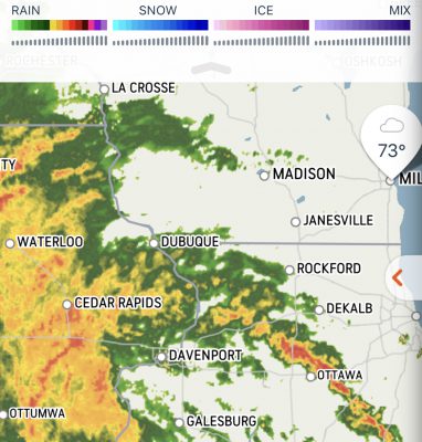
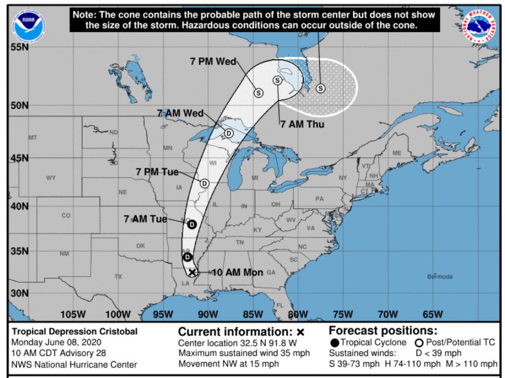
Flash flooding is possible for areas west of Madison this afternoon into tonight, including Lafayette, Iowa, and Sauk counties. There is also a small potential for a few tornadoes this afternoon and evening well inland from Lake MI, and is dependent on just how warm and humid it can get before the thunderstorms arrive. Minor flooding of creeks and low lying areas will be possible with the thunderstorms this afternoon and evening. Wind gusts of 30 to 40 mph are expected this afternoon and tonight as the remnants of Tropical Storm Cristobal move across the region.
What Has Changed
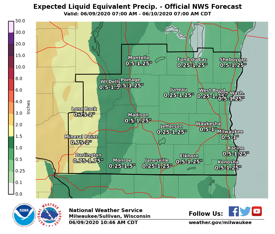
The axis of heavy rain has shifted a little to the east, so a Flash Flood Watch has been issued for Lafayette, Iowa, and Sauk counties. Only minor flooding of creeks and low lying areas will be possible with the heavier rounds of thunderstorms farther east from the flash flood threat.
Forecast Information
Where: All of southern Wisconsin
What: Flash flooding possible across Lafayette, Iowa, and Sauk counties. Small potential for a few tornadoes well inland from Lake MI, brief heavy rain and minor flooding away from the flash flood watch, and gusty winds of 30-40 mph but higher gusts possible with thunderstorms.
When: This afternoon and evening. Please view the attached timing graphic for thunderstorm onset times.
Impacts: Flash flooding possible across the mentioned western counties, with localized creek flooding and lowland flooding possible farther east.
The latest information on this storm from the National Hurricane Center.

Current Watches, Warnings and Advisories
Latest NWS Milwaukee Situation Report
NWS Milwaukee Website (for laptop/PC viewing)
Detailed Forecast via Cell Phone
Latest SPC Outlooks:
Southern Wisconsin: (Today) (Tomorrow) (Day After Tomorrow)
Wisconsin: (Today) (Tomorrow) (Day After Tomorrow)
Understanding SPC Severe Thunderstorm Risk Categories
Denny VanCleve
Forecaster