September 7, 2021 – Washington Co., WI – The National Weather Service has issued a severe thunderstorm warning for Washington County until 12:15 p.m.
According to the National Weather Service
* At 1126 AM CDT, severe thunderstorms were located along a line extending from near Hustisford to Johnson Creek, moving east at 55 mph.
HAZARD…60 mph wind gusts and quarter size hail.
SOURCE…Radar indicated.
IMPACT…Hail damage to vehicles is expected. Expect wind damage to roofs, siding, and trees.
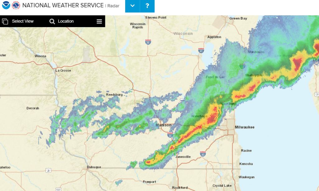
National Weather Service radar from 11:40 a.m. shows a line of storms extending from Janesville through the Sheboygan area.
* Severe thunderstorms will be near…
Hartford, Oconomowoc and Lac La Belle around 1135 AM CDT.
Delafield and Okauchee Lake around 1140 AM CDT.
Hartland and Merton around 1145 AM CDT.
Waukesha, Pewaukee, Sussex, Jackson, Germantown and Lisbon around
Other locations impacted by these severe thunderstorms include Richfield, Stone Bank, Summit, North Lake and Holy Hill.
Check your rain gauge and chime in with your rainfall totals.